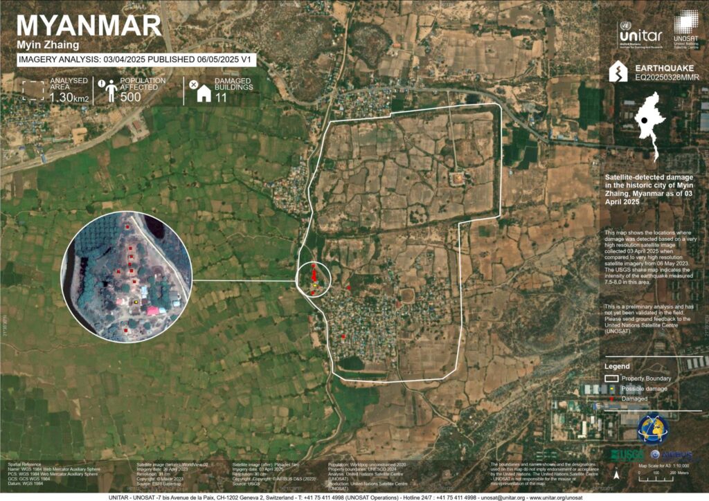
The March 2025 earthquake has affected many parts of Myanmar, including the historic city of Myinsaing. Based on preliminary analysis of UNOSAT satellite imagery, it is estimated that approximately 11 ancient structures in the old city may have suffered damage.
Why Ground Data is Important
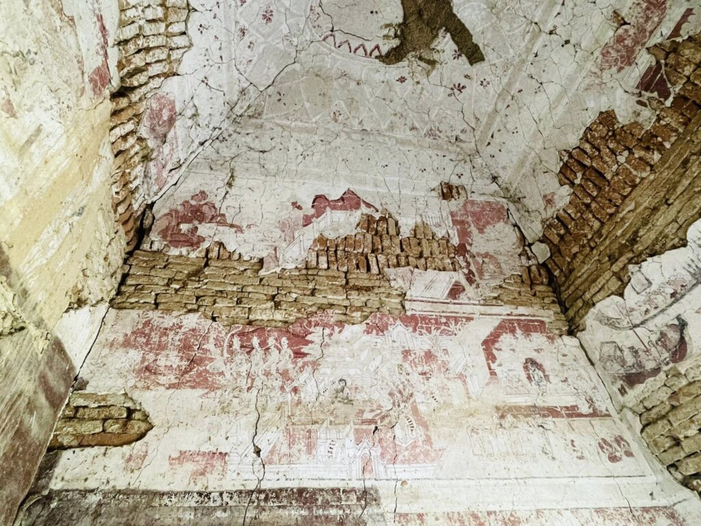
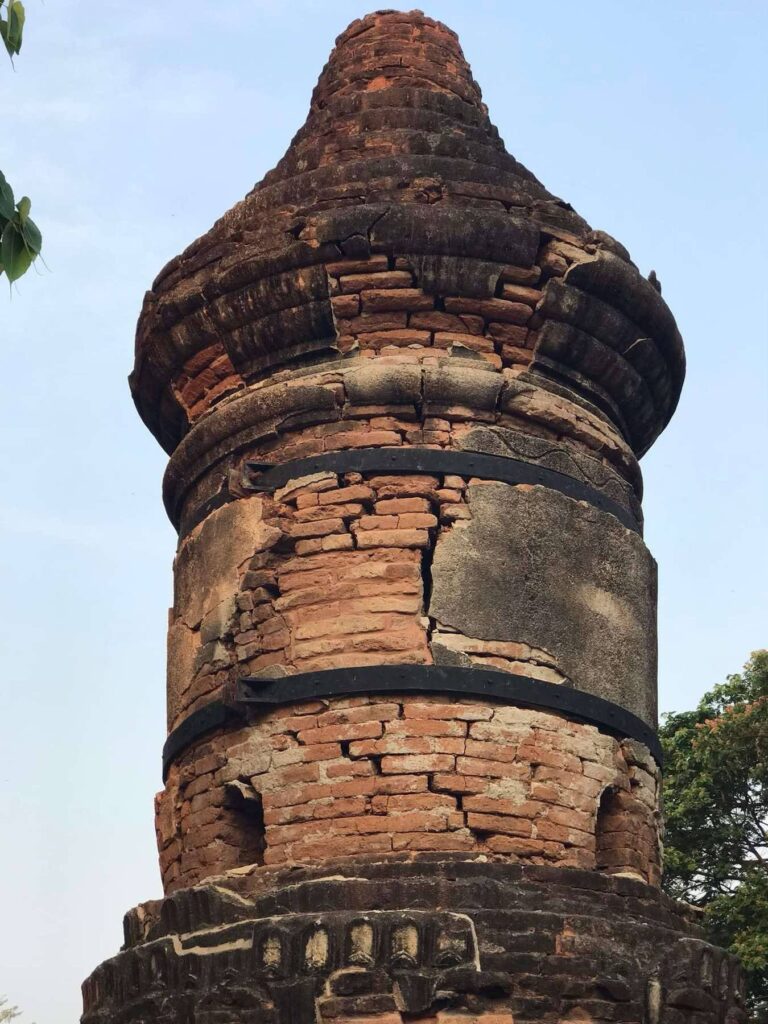
While satellite imagery provides an overview of potential damage, it cannot fully capture:
- The extent of structural damage
- Damage to artistic and architectural features, such as murals, stucco, and inscriptions
- Small-scale collapses or cracks that may threaten the integrity of the structures
For this reason, ground-level documentation is essential to create a complete and accurate record of the earthquake’s impact on Myinsaing’s heritage.
How You Can Contribute
If you have photos or videos from Myinsaing showing damaged heritage structures, you can help experts and authorities by:
- Downloading the Heritage for Myanmar (HFM) mobile application
- Submitting your images and location information through the app
- Providing any additional details about the affected sites, such as structural issues or displaced artifacts
Your contributions will help:
- Verify and supplement satellite data
- Inform restoration and conservation efforts
- Preserve the cultural and historical integrity of Myinsaing’s heritage
Take Action
📲 Download the Heritage for Myanmar App here:
By documenting heritage loss on the ground, you are playing a direct role in safeguarding Myanmar’s cultural legacy and ensuring that damaged sites are properly recorded and restored.
Heritage for Myanmar
- Heritage for Myanmar#molongui-disabled-link
- Heritage for Myanmar#molongui-disabled-link
- Heritage for Myanmar#molongui-disabled-link
- Heritage for Myanmar#molongui-disabled-link